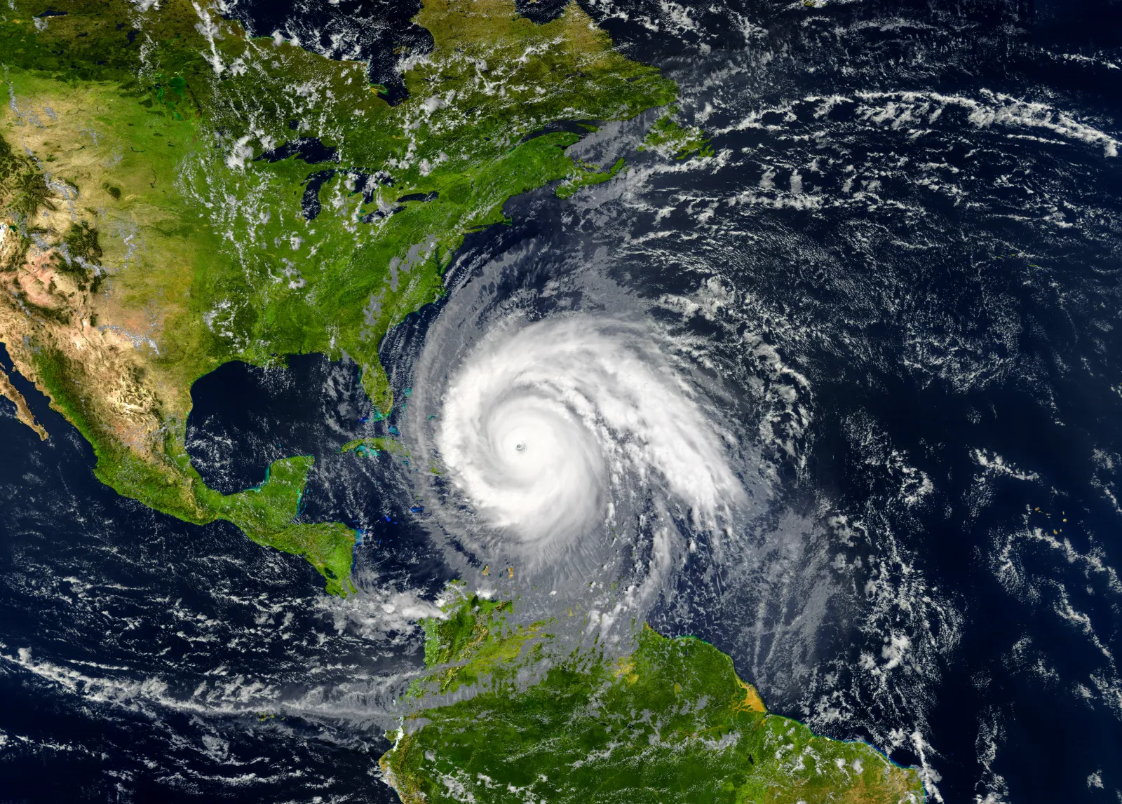
As of 5 AM on October 6, 2024, Tropical Storm Milton is located more than 700 miles west of Florida’s Gulf Coast and is expected to seriously impact the Treasure Coast. The storm is moving east at 5 mph and is expected to maintain this trajectory over the next few days, with a forecasted increase in speed and turn toward the northeast.
Milton’s maximum sustained winds have reached 50 mph, and the storm is projected to intensify in the coming days, likely becoming a hurricane this weekend. Hopefully wrapping up Florida’s 2024 hurricane season, forecast models indicate that Milton should escalate to a major hurricane as it traverses the Gulf of Mexico.

Rainfall poses a significant concern across the region. Expected totals range from 5 to 8 inches, with localized amounts possibly hitting 12 inches across the Florida Peninsula and the Keys. This rainfall raises the risk of flash flooding, urban flooding, and minor to moderate river flooding.
A state of emergency has already been issued for many Florida counties, including the Treasure Coast, Space Coast, and Palm Beaches.
In Martin County, the impacts are likely to include heavy rainfall and increased flooding risks. Residents near waterways should remain vigilant as river levels may rise significantly. Flooding could affect low-lying areas and roadways, complicating travel.
Read More: Martin County Hurricane Resources
St. Lucie County may experience similar conditions, with heavy rainfall forecasted. Officials warn of potential flash flooding, particularly in urban areas. Residents are advised to prepare for possible power outages and to have emergency supplies on hand.
Read More: St. Lucie County Hurricane Resources
Indian River County is also at risk as Milton approaches. The storm’s rainbands may bring substantial rainfall, increasing flood risks. Coastal residents should monitor local advisories, especially regarding storm surge potential and high winds.
Read More: Indian River County Hurricane Resources

As Milton approaches Florida, the potential for high winds and storm surge will grow, particularly in Southwest Florida. Many communities are still recovering from the impacts of Hurricane Helene, making this situation critical.
The National Hurricane Center predicts Milton may reach Category 3 strength by Tuesday afternoon, with landfall expected on Wednesday. Residents across Martin, St. Lucie, and Indian River Counties should prepare for potential storm surge and wind impacts, regardless of the storm’s exact path. Areas near bodies of water should remain vigilant and stay updated on the latest forecasts.
A tropical air mass will likely enhance rainfall coverage on Sunday and Monday, leading to a Flood Watch issued for the region through Thursday morning. Rainfall of 4 to 8 inches is possible over the next week, with excessive runoff heightening flood risks in low-lying areas.
The earliest arrival of tropical storm-force winds is expected around 8 PM on Tuesday. Residents are urged to complete outdoor preparations by that time.