Possibilities Rather Than Constraints…
Jeff Kivett attended Colorado State University; worked for 7 years in “water starved” Los Angeles; and now lives with his family in Martin County, working in a leadership capacity for the SFWMD. (Photo SFWMD public files.)

Regarding the outdated and failing water system of South Florida—of course there are “constraints.”
Everything in our material world is a “constraint,” but because we are human beings, creative and determined, we can “overcome” our constraints. ——but in order to do so, one must understand the “constraints” in the first place. Therefore, thank you to Jeff Kivett, P.E. Operations, Engineering and Construction Division Director, South Florida Water Management District, who created a recent power point on the subject. (https://www.sfwmd.gov/portal/page/portal/xrepository/sfwmd_repository_pdf/wrac_pres_system_constraints_2015_0205.pdf)
(https://www.sfwmd.gov/portal/page/portal/xrepository/sfwmd_repository_pdf/kivett_bio.pdf)

Recently US Sugar Corporation, and even some members from the Governing Board of the SFWMD itself , (https://www.sfwmd.gov/portal/page/portal/xweb%20about%20us/governing%20board) “hijacked” Mr Kivett’s document, to make it seem like it proves everything is “in stone,” justifies the atrocities of the plumbing system, and makes the idea of buying land south of Lake Okeechobee null and void….Nothing, could be further than the truth….and was not the intension of Mr Kivett’s document.
(https://www.sfwmd.gov/portal/page/portal/sfwmdmain/home%20page)
The way I see it, and after talking to Mr Kivett myself, he has given us a map “of flight.” A map for us to learn and understand how to overcome our present limitations. I am grateful to him for the map, and I will use it not to keep things the same, but to promote change.
________________________
Today I am going to share a document written by my friend Dr Gary Goforth. Dr Goforth (https://garygoforth.net) and I took Mr Kivett’s document and wrote about each “constraint” in such a way as to understand how to overcome it.
Please read, learn and speak out about it —- thank you for working to be part the solution and inspiration to “overcome,” the failures of the present South Florida system so that in the future it does not only provide flood control, but also provides even more clean, fresh water to the Everglades, and to South Florida, and no longer kills two of the most productive and economically important estuaries in North America, the St Lucie/Southern Indian River Lagoon and the Caloosahatchee.
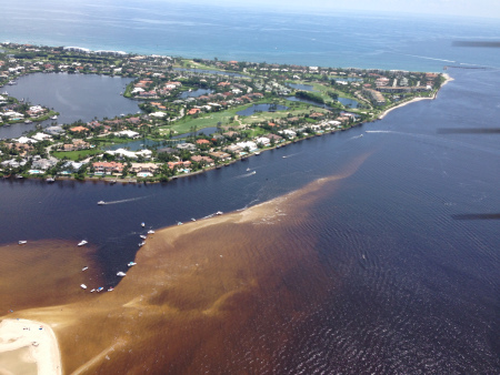
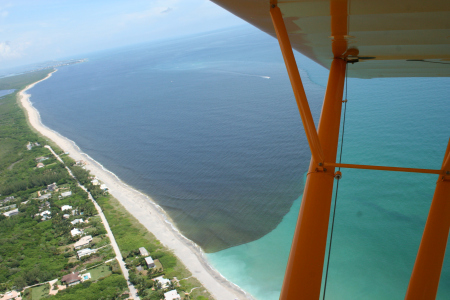
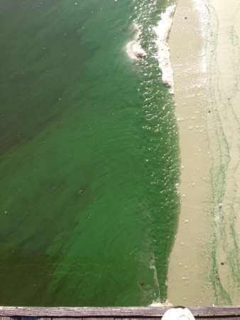

Please use the map to refer to the numbers from top to bottom.

______________________________________________________
Identifying and understanding system constraints is a fundamental step in identifying long-term solutions to minimizing destructive Lake releases to the estuaries. Many constraints represent short-term, i.e., daily or weekly, restrictions, and are not absolute limitations to achieving long-term goals. With proper planning, interim goals can be achieved in light of these short-term restrictions. Compiling the system constraints is particularly important to identifying long-term solutions for sending additional Lake water to the Everglades and minimizing destructive releases to the estuaries. A properly constructed “System Constraints” document provides fundamental engineering justification for the State to purchase available lands within the EAA in order to add to the storage and treatment necessary to achieve this long-term goal.
- Herbert Hoover Dike around Lake Okeechobee is a “dynamic constraint” since its importance in decision making is related to the time of year, the water level in Lake Okeechobee, and its structural integrity. At low water levels, the dike is not necessarily a constraint. Parts of the dike were constructed in the 1930s, and concerns over its structural integrity led to lowering the overall regulation schedule to the current interim operating schedule (LORS2008). It will be possible to hold more water in the lake, thus reduce the destructive discharges to the estuaries, as the U.S. Army Corps of Engineers continues the rehabilitation. The Corps has already spent $650 million in rehabilitation and they should speed this process up as fast as possible.
- Lake Okeechobee Regulation Schedule or LORS provides guidance on how much Lake water goes south and how much goes to the estuaries. The flexibility provided to the District and Corps to make lake operations decreases as lake water levels drop too low or rise too high, and as such, is also a “dynamic constraint.” LORS takes into consideration many factors, including the integrity of the Herbert Hoover Dike, the ecology of the lake ecosystem, and water supply needs of adjacent landowners. The current LORS (“LORS2008”) was developed in 2008 as an interim schedule in response to concerns about dike safety, and it is possible for it to be “reworked.” In light of the $650 million in rehabilitation work on the dike, the SFWMD could press for the Corps to revise LORS to provide greater storage in the Lake and reduce the destructive discharges to the estuaries. Senator Negron, Congressman Murphy and US Senator Rubio also have been breeching this subject. The Corps says that LORS will probably not be reworked until HHD is “fixed.” Another good reason to speed that up.
- Structure Capacity: “Structure capacity” refers to the amount of water that can be sent south during a relatively short timeframe (e.g., a day or a week) through the spillways and culverts located around Lake Okeechobee. The total structure capacity varies depending on Lake level and EAA canal level, allowing for different amounts of water to be sent south during different times of the year. Water control plans for regions like the EAA are developed to achieve long-term goals in recognition of short-term structure capacities. FYI: It is best to send water south all year round, especially in the dry season when the stormwater treatment areas (STAs) and Everglades need water at the same time the Lake water levels need to drop for the health of the Lake ecology and in anticipation of the upcoming wet season. Alternatives for minimizing estuary discharges that send additional Lake water south recognize this constraint, and include increased numbers and capacity of the structures along Lake Okeechobee.
- Canal conveyance capacity refers to the rate at which water can flow through a canal. During storm events, the EAA canals are used primarily to provide flood protection, however, these canals are not needed for flood protection every day of the year, and their capacity can then be used to deliver Lake water to the south. For this reason, canal conveyance capacity is not a fixed constraint in the context of making year-round deliveries of Lake water to the south. The canals could be enlarged to allow more water to go south. In addition, canal conveyance capacity could be increased as part of a flow-way/reservoir system constructed in the EAA on purchased option lands. This should be a goal with the new Amendment 1 funding.
- Species Protection. As water levels drop within the STAs during the dry season, migratory ground nesting birds (e.g., black necked stilts) and protected species (e.g., snail kites) find it conducive to build their nests. Once they nest in an STA, restrictions to protect the nests are put into place which severely limit the amount of water that can be sent through the STA. To discourage this nesting, the STAs’ Avian Protection Plan encourages a minimum depth of 6 inches. Achieving this operational guidance is a secondary benefit of treating Lake water in the STAs during the dry season. As an example, the only STA-5/6 with nesting snail kites at this time is STA-5/6 – coincidently the only STA that has not received Lake water.
- STA Treatment Capability. Overloading the treatment areas with nutrients from the EAA and Lake Okeechobee can adversely affect the ability of the STAs to optimally reduce phosphorus levels. However, as Lake water was delivered throughout the year at a relatively low rate, treatment performance has not diminished. In fact, STA performance has improved concurrent with the sustained delivery of historic large volumes of Lake releases to the south in a year-round operation. Over the last year, the outflow phosphorus concentration from STA-1E, STA-1W, STA-2 and STA-3/4 improved by 4 parts per billion (ppb), decreasing from 21 ppb to 17 ppb. The only STA that has not exhibited a performance improvement was STA-5/6 which did not receive any Lake water. In addition, District scientists indicate there have been no adverse impacts on the treatment vegetation due to Lake water.
- Pump Capacity: With the construction of the STAs, there is now more capacity to remove EAA floodwaters than ever before. This extra pumping capacity has also been used in the last year to significantly increase the delivery of Lake water to the Everglades. Many of the STA pumps are quite large and are not run 24/7. If smaller pumps can be built, additional Lake water could to be sent south “all day and night.” Amendment 1 funding could be used to construct additional pumps, purchase lands and build additional STAs or other features.
- STA 5/6 Connectivity: There are 5 STAs, and STA-5/6, located in Hendry County, is the only STA that has not received Lake water in several years. This STA has the poorest performance of the STAs and is currently the only STA with nesting Snail Kites, which places strict limits on allowable water depths within the STA. While a physical connection exists between the Lake and the STA, the associated operations are complicated. Improving the connection to the Lake should be a priority so even more Lake water can be sent south while providing hydrologic benefits to the STA. Portions of STA-5/6 can be sent directly to the northwest portion of WCA-3A, an area that needs Lake water to keep from drying out, without passing through the EAA canals.
- Wildlife Management Areas: Over 60,000 acres of public lands lie between the EAA and the lake, and water levels are managed to improve remnant Everglades habitat and are very important to wildlife. These areas are not being used to store and treat additional Lake water, and could be used to do so during the temporary periods of emergency releases from the Lake. The current operating schedule attempts to maintain water depths between 0 and 1 foot deep, which also provides suitable habitat for game hunting. The hunting community is our friend and we need to ask them for help during these temporary periods of emergency Lake releases.
- Water Level Limitation (Tree Islands & Wildlife): These areas, too, are very sensitive as the tree islands are sacred to our state’s native peoples/they are protected. The animals get on them when water is high to stay safe. It is only possible to send more water around them if it does not hurt the integrity of the tree islands. We should maintain good relationships with our native American friends; they have huge water problems too. Delivering treated Lake water to the WCAs throughout the year (not just during the wet season) and increasing out flows from the WCAs along the Tamiami Trail will help protect the remaining tree islands.
- LEC (Lower East Coast Canal Conveyance): These are canals that move local floodwaters and Lake O water east to replenish drinking water wellfields and send excess water into the Atlantic. They could be enlarged to increase their conveyance, although it would be better not to waste this water to the ocean, and instead, keep it within the south Florida system. As sea levels rise, additional Lake water will be needed to stave off saltwater intrusion in the coastal wellfields.
- Levee Safety: This earthen levee was built along the eastern boundary of the water conservation areas (WCAs) and keeps water from going into developed areas along the east coast. The safety of these levees places a constraint on the water depths within the WCAs. Water depths within the WCAs are a function of rainfall, evaporation, seepage and the movement of water into and out of the WCAs. Delivering treated Lake water to the WCAs throughout the year (not just during the wet season) and increasing out flows from the WCAs along the Tamiami Trail will help maintain safe water levels.
- Flow Limitation: The Tamiami Trail blocks the flow of water south into the Everglades National Park; more openings are being installed to increase this flow, and more could be put in for the future. Stringent limits of phosphorus are in place along the Tamiami Trail, and the State and Federal governments are currently discussing potential appropriate revisions. For the most recent year, the geometric mean of phosphorus was 5.6 ppb – well below the 10 ppb criterion.
- Flood Risk (G3273, South Dade Conveyance System): This area is around the city of Homestead, adjacent to the Everglades National Park. Right now they are having serious high-groundwater issues, stemming from the desire to hold higher water levels in Park. This is being studied and groundwater levels may be exacerbated with sea level rise. Potential solutions include construction of a cut-off wall to minimize seepage from the Park.
*The bottom line is that resolving “constraints” is only limited by our will and imagination and they should not be presented as “unchangeable.”
About Jacqui Thurlow-Lippisch:
Although born at Travis Air Base, California, Jacqui considers herself a native of Stuart, Florida, having moved there at eight months old. Her father’s family, originally from Syracuse, New York, has lived in Stuart since 1952. Her mother is a 5th generation Floridian from Gainesville. Jacqui is a Daughter of the American Revolution.
Jacqui is journalism graduate of the University of Florida, and an education master’s graduate of the University of West Florida. She went on to teach English and German and later after a serious accident of breaking her neck, started selling real estate. Later, she ran for public office having served on the Town of Sewall’s Point Commission since 2008, and is former mayor. During this time she saw the opportunity to help showcase the work of a locally formed river group, the River Kidz, and this has been her passion ever. She incorporates youth/river education into her political work for the St Lucie River/Indian River Lagoon.
Jacqui is the treasurer/secretary of the Treasure Coast Regional Planning Council; has chaired the Florida League of Cities Environmental and Energy Committee; was chair, and a six year member of the Treasure Coast Council of Local Governments; is an alternate for the Water Resources Advisory Commission for the South Florida Water Management District; and is a board member for Harbor Branch Oceanographic Institute Foundation, in St Lucie County. She also serves as a board member (ex-officio) for the Rivers Coalition Defense Fund, and is head administrator for her beloved River Kidz, now a division of the Rivers Coalition.
Jacqui’s reach involves not only local, but state and federal government. In 2013, she served on Senator Joe Negron’s panel for the Select Senate Hearing on the Indian River Lagoon and Lake Okeechobee. In 2014, she actively supported the elections of both Senator Joe Negron and Congressman Patrick Murphy who have both been strong supporters of Indian River Lagoon issues. In 2015, she is part of the Florida League Cities Treasure Coast Advocacy team to influence and educate Tallahassee. Jacqui received the Everglades Coalition’s 2015 “John V. Kabler Award” for “Grassroots Activism” working to organize and educate the public, generating grassroots support for Everglades restoration.
– See more at: (https://evergladescoalition.org/awards-kabler.html#sthash.lt7eGpIp.dpuf)
