2015 Annual Update, St Lucie River and Estuary Basin Management Action Plan, SLR/IRL
Plan, SLR/IRL

I did not attend yesterday’s meeting, but I do have copy of the “2015 Progress Report for the St Lucie River and Estuary Basin Management Action Plan.” The report is in PDF format so I cannot share in this post. Here is a copy of yesterday’s agenda: (https://www.dep.state.fl.us/water/watersheds/docs/bmap/meetings/AgendaStLucie-081215pdf.pdf)
Today I will try to provide some insights for every day people trying to figure out what a basin management action plan is, why we have one, and how we are doing so far….
Before we begin, we must first note that in 2002 the state of Florida declared the St Lucie River “impaired.” Impaired as in “its health”— with too much nitrogen and phosphorus and other pollutants from fertilizer and other sources that run off agricultural and developed lands…If you want, you can read the 2002 report below.
St Lucie River, Evidence of Impairment DEP : (https://dep.state.fl.us/southeast/ecosum/ecosums/SLE_Impairment_Narrative_ver_3.7.pdf)
Today we hear more about BMAPs (Basin Management Action Plans) and TMDLS (Total Maximum Daily Loads) than the original impairment report, but we must be aware that the only reason we have a BMAP is because the river is “impaired.”
Our Martin County/St Lucie St Lucie River (SLR) situation is compounded by the fact that the watershed has been heavily altered over the past 100 years. The Everglades Agricultural Area (EAA) south of Lake Okeechobee blocks the natural flow of Lake O. water going south to the Everglades; therefore the “overflow” waters of Lake Okeechobee are releases into the St Lucie.
On top of that are canals C-23, C-24, C-25 that go way out west expanding the St Lucie River’s basin, draining parts of Okeechobee and St Lucie counties and even waters of the St John’s River that used to go north once located near Vero! Road runoff, marinas, agriculture, our yards, tributaries, non-functioning septic tanks, and other things all add up to create a pollution cocktail that kills seagrasses and wildlife while lowering our property values for the entire area.
According to the St Lucie River Initiative our canals expanded the “flow” into the St Lucie River by as much as five times what Nature intended. See map below. The BMAP doesn’t really deal with this problem; it does not try to reroute these canals, it rather tries to “better the situation” we are in now as far as water inputs.

So with that in mind, let’s get back to the state of Florida’s created Basin Management Action Plans implementing “total maximum daily loads” (TMDLs) for nitrogen and phosphorus. “Everyone” is part of lowering their loads to the river through building projects that help lower loads and implementing Best Management Practices for fertilizer etc…. Everyone in the basin that is. (Not Lake O- They have their own plan). Not everyone is an equal polluter but everyone tries to lower their load.
The stakeholders agreeing to do projects and implement Best Management Practices to lower their inputs are:
Agriculture
City of Fort Pierce
City of Port St. Lucie
City of Stuart
FDOT District
Hobe St. Lucie Conservancy District
Martin County
North St. Lucie River Water Control District (NSLRWCD) 10
Pal Mar WCD
St. Lucie County
Town of Sewall’s Point
Troup-Indiantown WCD
These stakeholders work together with the help of DEP, the Department of Environmental Protection, and others to lower their measured inputs of Nitrogen and Phosphorus into the river over a period of fifteen years, in five-year increments beginning in 2013. The draft report now is just reviewing the first two years of the first five years. We have a long way to go….
This slide of the summary report provides some overall insights. You can see the load originally compared to now and how far they have to go together to achieve the first increment.

1.1 Summary of Accomplishments
Table 3 summarizes the projects completed during the second annual BMAP reporting period. These resulted in an estimated reduction of 118,163.3 lbs/yr of TN and 26,998.8 lbs/yr of TP. The reductions are in addition to those projects given credit before BMAP adoption. Therefore, the total reductions to date are 595,952.0 lbs/yr of TN and 157,540.8 lbs/yr of TP, which are greater than the required reductions in the first BMAP iteration of 316,024.2 lbs/yr of TN and 121,250 lbs/yr of TP. These reductions, in addition to those shown as completed in the BMAP, are 56.6% of the required TN reductions and 39.0% of the required TP reductions of the Phase I BMAP.
The progress towards the TMDL TN and TP load reductions in the St. Lucie River and Estuary Basin are shown in Figure 2 and Figure 3, respectively. The first bar in these figures shows the baseline load for stormwater runoff. The second bar shows the current estimated loading with the implementation of projects. The third bar shows the total allocation for stormwater runoff to meet the TMDLs. The line shows the target for the first BMAP iteration. (DRAFT REPORT)
____________________________________
So the St Lucie River BMAP is pretty making good progress according to the report. There is still a lot to improve. It is a process. We are learning….
These programs are definitely a major “participatory decision-making process” to be commended. I cannot imagine what it takes to coordinate this effort! It would be a nightmare actually. I rather just reroute the canals!
In closing we must note the Indian River Lagoon of which the St Lucie River is a tributary, has a BMAP, but it is for the central and northern lagoon not the southern lagoon where we are in Martin County. I don’t quite understand this. The river does not seem healthy in this area either.
Maybe one day soon the southern IRL will soon have its own BMAP too? A very complex process for two very sick rivers…A process we should all try to understand and help with too.(DEP BMAPS https://www.dep.state.fl.us/Water/watersheds/bmap.htm)


*According to the Department of Environmental Protection: a BMAP is a “blueprint” for restoring impaired waters by reducing pollutant loadings to meet the allowable loadings established in a Total Maximum Daily Load (TMDL). It represents a comprehensive set of strategies–permit limits on wastewater facilities, urban and agricultural best management practices, conservation programs, financial assistance and revenue generating activities, etc.–designed to implement the pollutant reductions established by the TMDL. These broad-based plans are developed with local stakeholders–they rely on local input and local commitment–and they are adopted by Secretarial Order to be enforceable.
*Also for the first five years of the fifteen years the BMAP will take place, the stakeholders are getting extra credit because the SLR “includes storm water management strategies and projects that have been put in place since 2000 or will be implemented during the first five years of implementation June 2013-June 2018).”
SLR SFWMD (https://www.sfwmd.gov/portal/page/portal/xweb%20protecting%20and%20restoring/stlucie#data)
*Thank you to former commissioner Tom Baush of Sewall’s Point who shared this report with me.
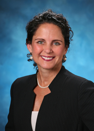 By: Jaqui Thurlow-Lippisch:
Although born at Travis Air Base, California, Jacqui considers herself a native of Stuart, Florida, having moved there at eight months old. Her father’s family, originally from Syracuse, New York, has lived in Stuart since 1952. Her mother is a 5th generation Floridian from Gainesville. Jacqui is a Daughter of the American Revolution.
Jacqui is journalism graduate of the University of Florida, and an education master’s graduate of the University of West Florida. She went on to teach English and German and later after a serious accident of breaking her neck, started selling real estate. Later, she ran for public office having served on the Town of Sewall’s Point Commission since 2008, and is former mayor. During this time she saw the opportunity to help showcase the work of a locally formed river group, the River Kidz, and this has been her passion ever. She incorporates youth/river education into her political work for the St Lucie River/Indian River Lagoon.
Jacqui is the treasurer/secretary of the Treasure Coast Regional Planning Council; has chaired the Florida League of Cities Environmental and Energy Committee; was chair, and a six year member of the Treasure Coast Council of Local Governments; is an alternate for the Water Resources Advisory Commission for the South Florida Water Management District; and is a board member for Harbor Branch Oceanographic Institute Foundation, in St Lucie County. She also serves as a board member (ex-officio) for the Rivers Coalition Defense Fund, and is head administrator for her beloved River Kidz, now a division of the Rivers Coalition.
Jacqui’s reach involves not only local, but state and federal government. In 2013, she served on Senator Joe Negron’s panel for the Select Senate Hearing on the Indian River Lagoon and Lake Okeechobee. In 2014, she actively supported the elections of both Senator Joe Negron and Congressman Patrick Murphy who have both been strong supporters of Indian River Lagoon issues. In 2015, she is part of the Florida League Cities Treasure Coast Advocacy team to influence and educate Tallahassee. Jacqui received the Everglades Coalition’s 2015 “John V. Kabler Award” for “Grassroots Activism” working to organize and educate the public, generating grassroots support for Everglades restoration.
– See more at: (https://evergladescoalition.org/awards-kabler.html#sthash.lt7eGpIp.dpuf)